
Sawtooth & Western Smoky Mtns
Backcountry Avalanche Forecast
Author: Zachary Miller
Issued: Wednesday, April 1, 2026 at 6:56 AM MDT
Expires: Thursday, April 2, 2026 at 4:00 AM MDT
The Bottom Line
 The Bottom Line
Watch for and avoid fresh wind drifts and slabs. You will find more, and larger, drifts and slabs as you climb from middle to upper elevations. At lower elevations, steer clear of steep slopes if you are sinking into a wet, mushy snowpack.
We will issue our last daily Avalanche Forecast of the season this Sunday, April 5th. We will issue General Avalanche Information updates through late April or early May.
Avalanche Danger
Wednesday, April 1, 2026
(⇡9000') 2 - Moderate
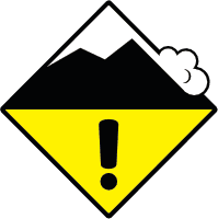
(7500-9000')2 - Moderate
(⇣7500')2 - Moderate
Thursday, April 2, 2026
(⇡9000') 3 - Considerable
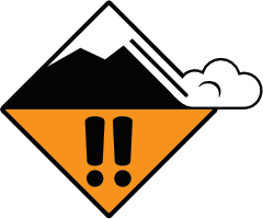
(7500-9000')2 - Moderate
(⇣7500')2 - Moderate
Avalanche Danger ScaleLearn moreGeneral InfoGeneral Information1 - LowLow2 - ModModerate3 - ConsConsiderable4 - HighHigh5 - ExtrExtreme
 1 - Low | 2 - Moderate | 3 - Considerable |  4 - High |  5 - Extreme | |
|---|---|---|---|---|---|
| Travel Advice | Generally safe avalanche conditions. Watch for unstable snow on isolated terrain features. | Heightened avalanche conditions on specific terrain features. Evaluate snow and terrain carefully; identify features of concern. | Dangerous avalanche conditions. Careful snowpack evaluation, cautious route-finding and conservative decision-making essential. | Very dangerous avalanche conditions. Travel in avalanche terrain not recommended. | Extraordinarily dangerous avalanche conditions. Avoid all avalanche terrain. |
| Likelihood of Avalanches | Natural and human-triggered avalanches unlikely. | Natural avalanches unlikely; human-triggered avalanches possible. | Natural avalanches possible; human-triggered avalanches likely. | Natural avalanches likely; human-triggered avalanches very likely. | Natural and human-triggered avalanches certain. |
| Avalanche Size and Distribution | Small avalanches in isolated areas or extreme terrain. | Small avalanches in specific areas; or large avalanches in isolated areas. | Small avalanches in many areas; or large avalanches in specific areas; or very large avalanches in isolated areas. | Large avalanches in many areas; or very large avalanches in specific areas. | Very large avalanches in many areas. |
Avalanche Problems (1)
Problem #1: Wind Slab
Problem Type
Wind Slab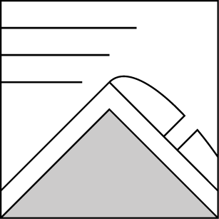
Aspect/Elevation
Likelihood
Size
You could find wind slabs up to 2 feet thick in exposed terrain. Wind slabs are largest and most widespread at upper elevations.
Recent cornice growth, pillows, and dunes are all clues that wind was at work moving snow. Look for shooting cracks as evidence of fresh wind slabs and a nudge to move to softer snow on more sheltered slopes. These slabs commonly form beneath ridgelines, on the sides of cross-loaded gullies, and lower in cirques below large cliff bands, chutes, and couloirs.
Forecast Discussion
Just when we thought winter had punched its timecard and clocked out - April Fools - it's back! With the return of snowfall, it's worth turning our brains back into winter mode and out of the simplified spring-diurnal mindset. Keep your head on a swivel for changing conditions if you're out enjoying the cold new snow, especially in areas where you find more than 6" of fresh snow. Spring storms are notoriously spotty in character, with large amounts of variability in the timing and quantity of snowfall across the landscape. Additionally, convective storms could produce graupel or other snow crystal types that form sensitive mid-storm interfaces. These interfaces make great failure layers for even thin wind slabs that quickly form above them.
Conveniently, the recent warm weather has solidified much of the snowpack below this new snowfall. On steep slopes where new snow is accumulating on firm, hard ice or wind-hammered surfaces, loose snow avalanches (sluffs) could release naturally or be easy to trigger and run faster and further than expected. At lower elevations near or below the rain-snow line, wet avalanches are still in the mix, and avoiding steep slopes where you find unsupportable wet snow is a great way to play it safe. Given the variety of conditions you may experience in the mountains today, be ready to pull the plug and switch to a more conservative plan B if you see obvious signs of instability or feel the hairs on the back of your neck stand up.
Mountain Weather
Author: Zachary Miller
Issued: Wednesday, April 1, 2026 at 6:00 AM MDT
Yesterday was overcast with light showers of snow and rain throughout the day, favoring the northern Sawtooth Range and Banner Summit areas. Rainlines climbed to roughly 8,000 ft before dropping around nightfall. Temperatures were in the upper 20s and low 30s F with moderate SW winds blowing in most mountain locations.
Last night, snow showers deposited an additional trace-2" in the mountains north and west of Galena Summit. The rain-snow line was around 7500'. Temperatures dipped to the mid to upper 20s F, and light to moderate S-SW winds blew on the ridgetops.
Today, expect intermittent snow or rain showers to deposit trace-4" of snow throughout the forecast area, with deeper accumulations in the northern and western zones. Mountain temperatures will climb into the low 30s F with light SW winds blowing at upper elevations. The rain-snow line should peak between 7500-7800' late this afternoon. This afternoon there is a chance of convective activity with possible thunder, lightning, and intensive precipitation localized to individual drainages, which adds uncertainty to snowfall forecasts.
Tonight, the storm intensifies, and widespread heavy snowfall is expected throughout the forecast area. By daybreak tomorrow, new snow accumulations are expected to be 8-15" in the Sawtooths, Banner Summit area, and Western Smokys, 6-10" in the Boulders, Galena Summit, Pioneers, and White Clouds, and 4-8" in the Soldiers with lesser amounts in the Wood River Valley. This all comes with moderate to strong W and SW winds and cooling overnight temperatures. Rainlines are forecast to drop to ~6,000' overnight.
Tomorrow, the storm will taper off with gradually clearing skies in areas south of Galena Summit and temperatures remaining cool in the mid-20s F. The Sawtooth Range, Western Smokys, White Clouds and Banner Summit areas could see an additional 2-6" of snow, falling primarily in the morning. Winds are forecast to remain moderate and blowing from the W.
| Sawtooth & Western Smoky Mtns | Last Night (5PM - 5AM) | Today (5AM - 5PM) | Tonight (5PM - 5AM) | |
|---|---|---|---|---|
| Temperature | 25 to 30 F | 28 to 33 F | 17 to 22 F | |
| Cloud Cover | Overcast | Overcast | Overcast | |
| Ridgeline Wind Speedⓘ | Light | Light | Moderate | |
| Wind Direction | S | SW | SW | |
| Snowfallⓘ | 12hr: 0 to 2 " | 24hr: 0 to 3 " | 2 to 4 " | 8 to 15 " |
| Snow Water Equivalentⓘ | 12hr: 0 to 0.2 " | 24hr: 0 to 0.3 " | 0.1 to 0.3 " | 0.7 to 1.2 " |
This information is provided by the U.S.D.A. Forest Service and describes general backcountry avalanche hazard and conditions.
It does not apply to ski areas and highways where avalanche mitigation is conducted.