
Sawtooth & Western Smoky Mtns
Backcountry Avalanche Forecast
Author: Zachary Miller
Issued: Thursday, April 2, 2026 at 6:53 AM MDT
Expires: Friday, April 3, 2026 at 4:00 AM MDT
The Bottom Line
 The Bottom Line
Traveling in avalanche terrain requires a cautious and conservative approach today because triggering a large avalanche is likely. If you find that you’re riding or sliding in new snow deeper than 6 inches, especially in wind-affected locations, be on the lookout for cracking or collapsing as obvious signs to choose mellower slopes.
We will issue our last daily Avalanche Forecast of the season this Sunday, April 5th. We will issue General Avalanche Information updates through late April or early May.
Avalanche Danger
Thursday, April 2, 2026
(⇡9000') 3 - Considerable
(7500-9000')3 - Considerable
(⇣7500')2 - Moderate

Friday, April 3, 2026
(⇡9000') 3 - Considerable
(7500-9000')2 - Moderate
(⇣7500')1 - Low

Avalanche Danger ScaleLearn moreGeneral InfoGeneral Information1 - LowLow2 - ModModerate3 - ConsConsiderable4 - HighHigh5 - ExtrExtreme
1 - Low | 2 - Moderate | 3 - Considerable |  4 - High |  5 - Extreme | |
|---|---|---|---|---|---|
| Travel Advice | Generally safe avalanche conditions. Watch for unstable snow on isolated terrain features. | Heightened avalanche conditions on specific terrain features. Evaluate snow and terrain carefully; identify features of concern. | Dangerous avalanche conditions. Careful snowpack evaluation, cautious route-finding and conservative decision-making essential. | Very dangerous avalanche conditions. Travel in avalanche terrain not recommended. | Extraordinarily dangerous avalanche conditions. Avoid all avalanche terrain. |
| Likelihood of Avalanches | Natural and human-triggered avalanches unlikely. | Natural avalanches unlikely; human-triggered avalanches possible. | Natural avalanches possible; human-triggered avalanches likely. | Natural avalanches likely; human-triggered avalanches very likely. | Natural and human-triggered avalanches certain. |
| Avalanche Size and Distribution | Small avalanches in isolated areas or extreme terrain. | Small avalanches in specific areas; or large avalanches in isolated areas. | Small avalanches in many areas; or large avalanches in specific areas; or very large avalanches in isolated areas. | Large avalanches in many areas; or very large avalanches in specific areas. | Very large avalanches in many areas. |
Avalanche Problems (2)
Problem #1: Wind Slab
Problem Type
Wind Slab
Aspect/Elevation
Likelihood
Size
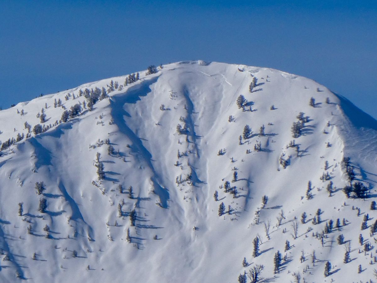
Large avalanche on Eureka Pk in the same area as human-triggered slides from (2/9). NE @ 9,900'.
Photo: Sawtooth Avalanche CenterTriggering a large 2-3' thick wind slab is likely today in exposed upper and middle elevation terrain. Plumes of ridgetop snow, recent cornice growth, pillows, and dunes are all clues that wind was at work moving snow. These slabs are expected to be found beneath ridgelines, on the sides of cross-loaded gullies, and lower in cirques below large cliff bands, chutes, and couloirs.
Look for shooting cracks and feel for firm or hollow drum-like surfaces as evidence of fresh wind slabs and a nudge to move to softer snow on more sheltered slopes.
Problem #2: Dry Loose
Problem Type
Dry Loose
Aspect/Elevation
Likelihood
Size
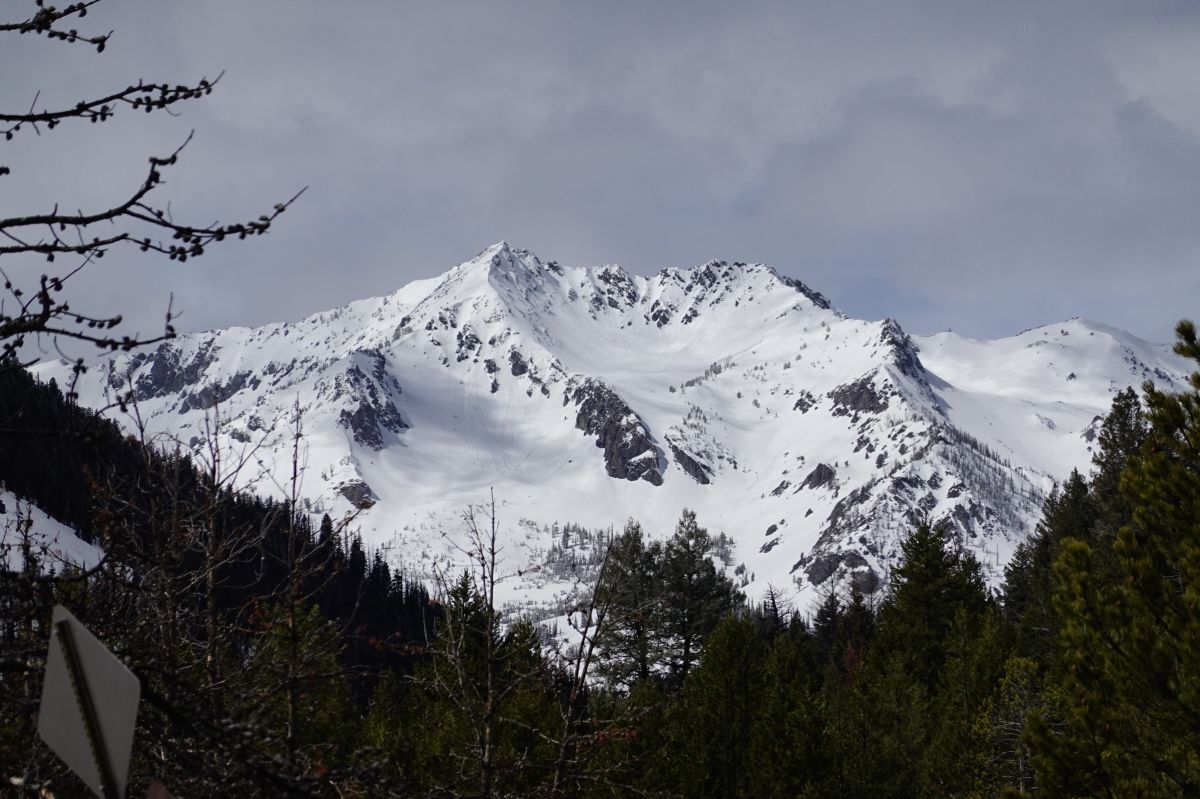
Small natural loose avalanches on Saviers Peak observed on April 1, 2026.
Photo: Sawtooth Avalanche CenterOn more sheltered slopes, the combination of 6-12 inches of uncohesive new snow and firm old snow surfaces could result in natural and easily triggered dry loose avalanches. Loose avalanches may run faster and further than you expect given the underlying firm surfaces from our previous week or two of warm weather. These “sluffs” may start out small but can gain momentum and volume as they move downslope, carrying you somewhere that you may not want to go. Avoid travelling above terrain that amplifies the consequence of being caught (aka terrain traps) and choose mellower slope angles if the sluffing is getting out of hand.
Forecast Discussion
This may well be the last powder day of the season, but don’t let the relative scarcity of snow this year get to your head—it's western out there today, and there are still real consequences to triggering or being caught in avalanches. The inherent volatility of spring storms and the variability of new snow distributions during these events add uncertainty to our mental hazard equation. Larger amounts of uncertainty lead us to build in larger margins for error. We build these margins by having multiple route options planned and minimizing our exposure to the hazard by traveling through avalanche terrain one at a time. Being extra aware of changing conditions and obvious signs of instability are key skills to apply if you’re out playing in this distinctly spring-style storm today.
Mountain Weather
Author: Zachary Miller
Issued: Thursday, April 2, 2026 at 5:47 AM MDT
Yesterday was mostly cloudy with intermittent snow and rain showers that accumulated a trace to 2 inches of new snow in the mountains. Temperatures climbed into the low to mid-30s F, and light S and SW winds blew at ridgetops. Rain lines lingered at ~8000 feet throughout the day.
Last night, widespread snowfall graced the area with a fresh 3-10+ inches of new snow falling by 4am this morning. Temperatures dropped into the mid to low 20s F, and moderate winds blew from the S and SW, with stronger winds blowing in areas south of Galena Summit. Rain lines dropped to ~5800’ overnight.
Today, expect the snowfall to continue with an additional 2-8 inches falling, favoring the Sawtooth Range and Western Smokys. Winds will remain strong from the W, and temperatures will continue to drop into the teens to low 20s F. Rainlines will be well below the valley floors in most locations.
Tonight, the faucet is forecast to shut off, with a trace to 1 inch of snow falling. NW flow aloft brings cold air with it that will drop temperatures into the low teens F. The winds will continue to blow moderately from the NW and gradually decrease to light strength starting in the northern ranges and working south tomorrow morning.
Tomorrow, skies will rapidly clear out, and temperatures will climb back into the mid-30s F by early afternoon. Winds will blow lightly from the NW, and there is no snowfall expected.
| Sawtooth & Western Smoky Mtns | Last Night (5PM - 5AM) | Today (5AM - 5PM) | Tonight (5PM - 5AM) | |
|---|---|---|---|---|
| Temperature | 19 to 24 F | 13 to 18 F | 12 to 17 F | |
| Cloud Cover | Overcast | Overcast | Mostly Cloudy | |
| Ridgeline Wind Speedⓘ | Moderate | Moderate | Moderate | |
| Wind Direction | S | W | NW | |
| Snowfallⓘ | 12hr: 3 to 9 " | 24hr: 5 to 12 " | 2 to 8 " | 0 to 1 " |
| Snow Water Equivalentⓘ | 12hr: 0.2 to 1.2 " | 24hr: 0.4 to 1.4 " | 0.15 to 0.5 " | 0 to 0.1 " |
This information is provided by the U.S.D.A. Forest Service and describes general backcountry avalanche hazard and conditions.
It does not apply to ski areas and highways where avalanche mitigation is conducted.